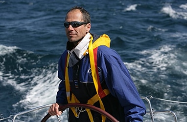
This article is an excerpt from NauticEd’s online Skipper Large Keelboats Course, a comprehensive online sailing course for beginner to intermediate sailors to learn how to sail large sailboats 26 ft (8m) and above. The Skipper Large Keelboats course is part of the Skipper Course Bundle of online courses, also teaching you how to master maneuvering under power and docking!
You can learn to sail and improve your sailing with NauticEd, the international leader in sailing education.
Navigation Introduction
The history of navigation is fascinating and dates back as many centuries as we can imagine.
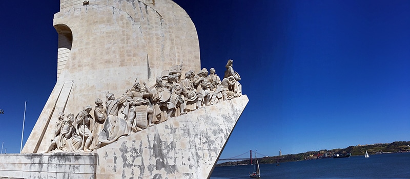
Above is Padrão dos Descobrimentos (Monument to the Discoveries) in Lisbon, Portugal. The monument is dedicated to Henry the Navigator and the other discoverers of the 15th and 16th centuries who opened the trade routes to India and the Orient.
The Duke of Viseu, better known as Henry the Navigator opened what is known today as the Age of Discoveries. Henry was the son of the Portuguese King John I and was responsible for the early development of Portuguese exploration and maritime trade with other continents through his planned and gradually expanding exploration of Western Africa and the islands of the Atlantic Ocean as he searched for a new and faster route to the wonders of the Far East.
Today with Google Maps in our pocket, we can’t even conceive what these brave souls went through every day.
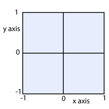
Years ago, the French mathematician and philosopher René Descartes cleverly invented a way of locating points on a flat surface. He simply drew two perpendicular lines, called them the x- and y-axis, and then put a scale of numbers on each axis.
Cartesian Coordinates
Descartes showed how convenient and powerful it is to locate a point in a plane (flat surface) by using a set of two numbers—called the x and y coordinates. This arrangement became known as the Cartesian coordinate system and because it linked geometry and algebra, mathematics was forever changed.
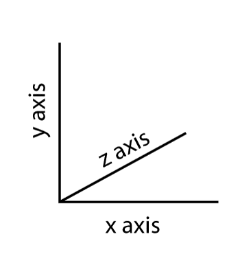
If you wish to locate a point in space you need a third coordinate for depth. This is known as the z-axis.
Three Dimensional Coordinates
Everyone is familiar with using a tourist street map in which a pair of coordinates—often a letter and a number—is given for any point you wish to locate. For example, you might see in a street map index that 100 Sir Edmund Hillary Street is at coordinates A-6.
Airplanes and submarines use three sets of numbers because they need depth or altitude to identify their exact location in three dimensions.
A pair of coordinates also assist in surface navigation for sailors. However, there is a problem with Cartesian coordinates: the globe is round, not flat.
Early cartographers quickly realized that since the Earth is round, putting information from a sphere onto a flat piece of paper created distortions. They needed another system.
The major difference in locating points on a flat surface and a round surface like the globe is that on a flat surface, distance can go on indefinitely, while on a spherical surface, you keep going around and around. Thus, there has to be a slightly new set of rules that allow unique coordinates to continue to work. These involve equators, meridian lines, hemispheres, and poles for example.
Maps commonly used for navigating are Mercator projections. Named after Gerardus Mercator, a Flemish geographer, who developed a system in 1569 that is still used by sailors today: latitude and longitude coordinates.
You can learn more in the Skipper Course....
Knowledge and theory for longer distances and overnight sailing in diverse conditions. The Skipper Course is a comprehensive online sailing course for beginner to intermediate sailors wanting to learn how to sail larger sailboats 26ft to 56ft. Or upgrade to the Skipper Course Bundle of online courses to also master maneuvering under power and docking!