This article is an excerpt from NauticEd’s online Skipper Large Keelboats Course, a comprehensive online sailing course for beginner to intermediate sailors to learn how to sail large sailboats 26 ft (8m) and above. The Skipper Large Keelboats course is part of the Skipper Course Bundle of online courses, also teaching you how to master maneuvering under power and docking!
You can learn to sail and improve your sailing with NauticEd, the international leader in sailing education.
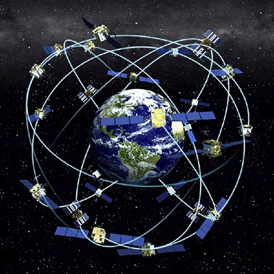
Global Positioning System
GPS stands for global positioning system. It uses a network of satellites in orbit. Although the GPS is used as a navigation device, it is also a form of communication to the vessel. Thus we include it here. It’s pretty interesting stuff.
Deep ThoughtsImagine if in the 1700’s John Harrison gave Captain James Cook a few satellites and an iPad loaded with a Navionics app instead of a chronometer (a watch). Oh man! Cook would have probably taken about 20 minutes to master the concepts. Us? It’ll take a little study. Cook was indeed a very clever master of the ocean and navigation. |
A GPS receiver calculates its position by precisely measuring the time difference between specifically timed signals sent by GPS satellites high above the Earth. Global Navigation Satellite Systems (GNSS)—Global Positioning Systems (GPS)—give navigators unique real-time tools, but there are a few things to learn before jumping in. Don’t just assume that a GNSS will do the job for you once you’re out there. Now’s the place and time to understand the power of knowledge and the depth of information such a device can give to you.
Each satellite continuously transmits data messages that include:
- The time the message was transmitted, and
- Satellite position when the message was transmitted.
The receiving unit uses the time differences between the messages from each satellite. From this, it determines the transit time of each message and thus computes the distance to each satellite using the speed of light. These distances are used to compute the location of the receiver using spherical geometry equations.
Basic GPS measurements yield only a position, not speed or direction. However, most GPS units can automatically derive velocity and direction of movement from two or more position measurements over time.
Notice from the above that the device on your vessel does not communicate back to the satellite. The information received from the satellite: exact (exact) time of day and satellite location are sufficient.
A final wonder in regard to this whole concept is that we have instruments that can measure differences in distance using light traveling this fast. It’s incredible and kudos go to all the engineers (and begrudgingly the politicians) who made all this possible—and as a free service to the world.
Here is a very cool animation on Wikipedia of satellites orbiting the earth. You can hover over any orbit to highlight it.

Satellites in Orbit
Practical Navigation with GPS
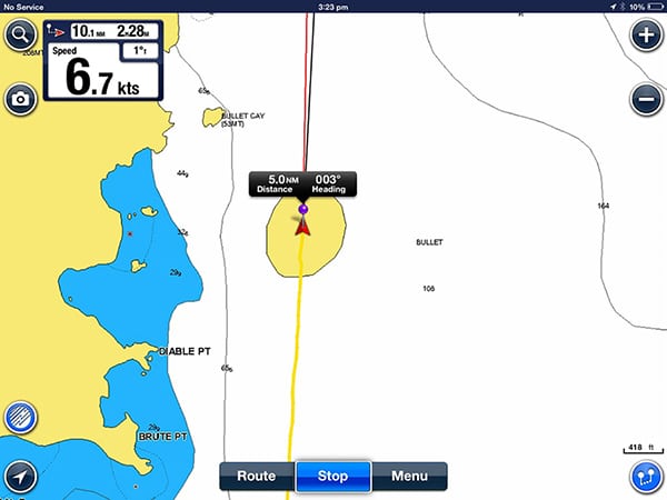
Today, it is probable that in addition to your main chart plotter, you will have multiple other GPS devices on your vessel, things as phone and tablet devices. So reliability and redundancy are high. Additionally, there are multiple satellites being used. The more satellites the device can see, the more confidence in the accuracy of the position. A GPS device will allow you to see how many satellites it is seeing and will thus give you its own confidence value. This value is called the Horizontal Dilution of Precision (HDOP).
It is unlikely that multiple satellites go offline at the same time. So given all the above, it is reasonably safe to say that relying on GPS navigation is a sane(ish) thing to do. HOWEVER, given that you can’t breathe water, it is NOT prudent to rely solely on GPS for the following reasons:
- GPS units can fail.
- Your batteries and thus recharging ability are down.
- Your aerials fail.
- You roll in a storm and everything is shorted out.
- There is a solar flare interruption of the satellite signals.
- You are struck by lightning and everything is fried (it happens).
In addition, the information stored in a GPS digital chart is only as good as the information originally entered. Older paper charts are scanned and digitized into a chart plotter. The accuracy of the information presented by the GPS will depend on the age of the charts.
Prudence means regularly maintaining a logbook of your positions, double-checking your position on a paper chart, and using visual aids of landmarks, buoys, depth soundings, and oil platforms, for example. At sea, a prudent captain will contact passing container ships for a double check of position.
Knowledge of both paper charts and how to use them combined with electronic chart information is the wise thing to do.
GPS and the Speed of Light
Galileo is often credited with being the first scientist to try to determine the speed of light, in 1638. His method was quite simple. He and an assistant each had lamps that could be covered and uncovered at will. Galileo would uncover his lamp, and as soon as his assistant saw the light he would uncover his. By measuring the elapsed time until Galileo saw his assistant’s light and knowing how far apart the lamps were, Galileo reasoned he should be able to determine the speed of the light. His conclusion: “If not instantaneous, it is extraordinarily rapid.” Galileo deduced that light travels at least ten times faster than sound.
(Source credit http://www.speed-light.info/measure/speed_of_light_history.htm) The speed of light was further refined over the centuries. In 1862, Leon Foucault determined the speed of light was 299,796 km/s. Today the adopted speed of light is 299,792.458 km/s—only 4 km/s different from Foucault.
Simplified – How GPS Works
It’s pretty simple really. Place three people around the edge of a duck pond at known angles from each other. Each holds one end of a piece of string with the other end tied to a rubber duck. By knowing the length of each piece of string you could very accurately determine the duck’s exact and unique position inside that circle.
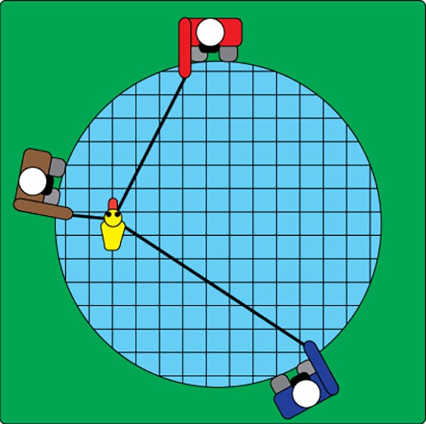
How a GPS Works
With GPS, the length of the string is the time it takes for the signal to get from a satellite to you. By knowing the time traveled for at least three satellite signals, the software inside the device can accurately calculate your unique position on Earth at a particular moment in time. One second later the same calculation can be done and a new position is established. Armed with this information, the device can report speed and direction findings.
Electronic Charts
Lesson Number One: Sailing instruments do not replace a sailor’s natural senses; they help only to enhance and validate them.
GPS charts use the same data accuracy concept as computers, but keep in mind the concept of GIGO, which stands for Garbage In Garbage Out. Initially, when digital data first came on the scene, digital maps were created from paper charts, and paper charts were created from the latest information available. Going back a few more years, charts had serpents and giant squid—these could equally have been digitized. Remember that your digital charts are only a representation of known information—not all information. In some cases, chart information still exists based on sextant celestial navigation information from way back. For example, we know where the Kingdom of Tonga is, but are the positions of rocks and reefs known around Tonga exactly within 6 feet?
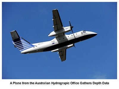
Today, many coastal areas ARE accurately charted using high-tech hydrographic equipment. Airplanes beaming red and green lasers down into the waters can digitally document with ridiculous accuracy the landscape of the bottom. Red lasers bounce off the surface and green lasers bounce off the bottom. The time differential tells the depth.
Using this method, a pass by an airplane at 250 knots can digitize a swath of coastline 250 meters wide. The data collected is hundreds of terabytes, detailing rocks the size of a basketball on the bottom. This data is then reduced to create a very accurate chart. The trouble is, we don’t know if the digital chart we are using was created from a paper chart with serpents or from lasers.
Another example to keep in mind was an accident report of a yacht hitting a long pier at night. It wasn’t on the digital chart. The pier was built after the yachtsman had updated his digital charts. And think of a recent sunken vessel that is not on the charts. It is thus prudent to keep watch as well as check your charts.
Interesting QuestionHere’s a situation from a recent bareboat charter trip to St. Vincent and Bequia Island in the Caribbean: Pick which of the following statements is true.
The truth is the island does not exist and for purposes of this exact electronic navigation discussion, I purposely steered the boat right through it. There was no change in depth as we went through it. It is not named nor does it have a height listed on the chart, but all the other islands do list a height. |
Ultimately we must also be cognizant that electronically stored information is subject to failure because of lightning strikes, coffee spills, a knockdown, battery failure, hard drive failures, aerial failures, solar flares, satellite failures, and much more. A lot can go wrong with disastrous consequences to you personally if you’re not thinking and preparing. So always make sure that you back up your positions on paper in your logbook and on the paper chart.
You can learn more in the Skipper Course....
Knowledge and theory for longer distances and overnight sailing in diverse conditions. The Skipper Course is a comprehensive online sailing course for beginner to intermediate sailors wanting to learn how to sail larger sailboats 26ft to 56ft. Or upgrade to the Skipper Course Bundle of online courses to also master maneuvering under power and docking!